I have written over 400 posts (okay, some of them songs, news and puzzles), You can use Search or the menus to find your place to walk.
This post was the first walk in 2009. We still love it. What’s new? The northside trail has been paved and repaved. The Creek has been cleaned of reeds and multi-trunked trees. It has flooded to the west of Willowside. It’s pretty dry now, in places almost looking like a series of ponds. In spring, the egrets, mallard, mergansers and robins are busy. A kingfisher will dare you to spot him. I’ve missed the osprey the last two years. Anyone seen him?
The city as created new trail maps, here’s the one for this area. Santa Rosa Creek.
Meanwhile back to walking…
On last Sunday’s walk I was greeted with much singing. By birds. Robins to be exact. They sat at the top of bare branched trees and occasionally flew off in groups and landed not far away. What the attraction was, I have not been able to determine. They didn’t seem to be feeding or doing that spring preparation thing birds do. Maybe they just love to sing.
I chose this as my first blog walk because I go there often and because it offers many landscapes of Sonoma County. It has a rich riparian environment, vineyards, horse pastures and agricultural fields. It looks like a walk on a country lane next to a creek with mountains in the distance. It’s wild and yet close to town.
Let’s start at the beginning. Park on Willowside Road just north of the Waldorf School near the bridge at Santa Rosa Creek. This is between Hall and Guerneville Roads west of Santa Rosa. Try not to ditch the car, or cause your passenger to nose dive down the bank upon exiting the car. Also, try not to park in the roadway either, for Willowside is almost the highway Guerneville Road can be.
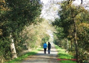
Sunday, my husband and I chose to walk heading east on the north side of the creek. The water level was up from Saturday’s rain, though it had evidently fallen already as brush had piled up on the upstream side of the trees. A winter creek can be noisy and exciting. Since this creek is part a flood control system, it shouldn’t get too exciting.
To prevent any possible flood, raised embankments on either side of the creek contain the waters and provide a level walking trail. The path is hard packed gravel that from the rain was spongy and muddy in spots. Though not even, it’s a good surface with sturdy shoes.
The creek supports many willows, while oaks and pine trees border the path. The bright orange and red berries of September’s mulberries are gone. This time of year everything seems stripped, but the potential for abundant growth is there. Now, you get to see more of the raw land without all those darn leaves in the way.
After the flurry of robins, I started noticing couples and groups of mallards in the creek, some of them making good headway upstream. There is supposed to be steelhead and Coho salmon in this stream, but I’ve never seen them in this stretch.
Chickens clucked and dogs barked from the farm on the left and the sound of cars from Guerneville Rd. became more noticeable.
Since it was a stormy day, the clouds were a mix of grays with occasional white spots of sun breaking through. They showed off the violent yellow green of meadows on the hills to the northeast contrasting with the dark trees and the white houses. The patterns and colors were constantly shifting.
The walk on the north side of the creek provides good views of the creek to the right. On your left you will pass barren corn fields, two horse jumping courses, a dairy cow pasture with cows huddled to feed, and vineyards.
There are three creeks that feed into Santa Rosa Creek before you get to Fulton Rd. Each crossing has a sturdy cement base bridge and reassuring steel trusses. No chance to fall in. These other creeks are also lined with paths to extend your walk.
At the second creek, we spotted an egret fishing or hoping for fish.
While admiring the views of the creek and the mountains, we came to a spot just down stream from Piner Creek where the creek turns. We had enjoyed a trash free view of the creek, but here it had piled up. If we were more intrepid and had boots on, we might have liberated some of this plastic crap from the creek. (There are bags available at Willowside for your dog’s stuff, lest you forget.)
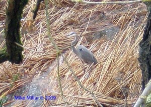
We walked on enjoying a box elder with its pale brown leaves still clinging to its branches. At the Piner Creek crossing, we found a blue heron searching the creek. This is as far as we went Sunday, about a mile and a half out — and amazingly the same back.
There were several other walkers, a few joggers and non-Lycra clad bicyclists. Most dog walkers had their pups on leashes, as they should be. This is not a crowded walk, though I was concerned on Thanksgiving when on our return, we kept meeting large family groups. “Who was cooking?” I wondered.
Today on our way back we heard the squawk of osprey and frog, but couldn’t see either. The robins were still in the trees nearer Willowside.
All the stuff I couldn’t fit in above…
Thank The Sonoma County Regional Parks responsible for this section of the creek. (The City of Santa Rosa takes care of the parts east of Fulton.)
Recommendations: Hiking boots, due to the gravel. It’s hard on the feet with thin soles.
Bathrooms and benches: There are none. Plan accordingly.
Creek trail map: Provides you with a map of Santa Rosa Creek trails – new version with distances.
In July 2010 the north side of this trail was paved and it’s cracked and been repaved a few times since then . Most bicyclist will use that side. South side is nicer walk anyway.
Length: 2.2 miles from Willowside to Fulton. Santa Rosa Creek is 22 miles long. On this stretch 3 creeks join in and provide other flat walking trails. (Wendel or Abramson, a convergence of Peterson and Forestview and Piner.
Food: Head west to Hwy 116 for Mom’s Apple Pie or head back to Santa Rosa for many many possibilities. New in 2013: many fun places have opened at the Barlow Center in Sebastopol – could be worth the trip.
Other walks: Link to more Santa Rosa Creek one year later. More trees and more shade to protect against summer heat. Walking west from Willowside the paths are mostly dirt and grass. I don’t find them as interesting, until you get to the end and feel you are in the real Laguna de Santa Rosa, even though it’s all around you.
Enjoy every walk.
Lynn Millar
The pictures are taken at the Santa Rosa Creek near Willowside by my husband, Mike.
 We continue to enjoy walking this section of Santa Rosa Creek. Here’s a video Mike took in December 2014.


Great Santa Rosa Creek Trails map, Lynn! Thanks for the link. Dianne