Last week we walked a new trail around a landfill in American Canyon. Sounds perfect, right?
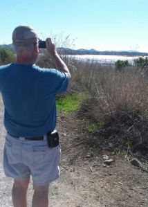
Well, it was beautiful to be along the Napa River and have views of Sonoma Mountain, Mt Tamalpais and Mt. Diablo. The trail was new segment of the Bay Trail – that will someday go all around San Francisco Bay. As this area is being restored, the trails here go through a marsh and wetland area of the Napa River. (Click here for online map of Bay Trail.)
Out Eucalyptus Drive (from Hwy 29 to Rio del Mar and right on Eucalyptus,) is a spiffy new parking lot, with benches and picnic tables. The trailhead is to the right.
The trail heads straight out to the land fill. My kind of trail, nice and flat with plenty of water around.
In a quarter of a mile, a trail takes off to the right on another mile loop.
 Continuing on, the tail heading west goes by a pond to the right.
The trail turns south. The landfill is on the left, grasslands to the right and some sand dunes at the river – until the trail nears the river.
 Old cement is piled up creating a re-bar sculpture.
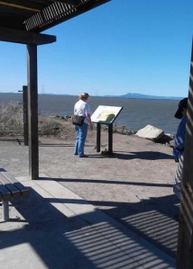
Near the Napa River is an outlook. As someone said a poor person’s telescope. Actually, they just focus your view on a particular site.


Love this sentiment – We All Live in a Watershed. A good thing to remember when we’re using water, treading over the land and throwing our trash away.
We continued on around the landfill, catching sights of more ponds and mountains.
The trail curved on.
This is the end of the loop around the landfill (which could be the beginning if you choose.) The sign talks about converting the methane – produced from the landfill – to electricity. That’s what the buildings contain and the valve releases aid in .
We’re going to do another section at the JFK Memorial Park, next Tuesday. Sign up with Senior Walkabouters – or go on your own.
For more of the places we have walked – click our Bay Trail.
Click Bay Trail to find more trails around the bay.
Distances: Two and a half mile walk, as written above. Loop to the right near the beginning of the trail adds another 1/2 mile. A side trip to the river and back, before the turn left to the south adds over another 1/2 mile.
Map. (beware all maps – this shows the Paintball Jungle where the parking lot is.)
Benches and picnic tables: Near the parking lot.
Wheelchair accessible: Yes
Dogs: On a leash
Bathroom: Portapottie at parking lot.
Other walks nearby: Besides the other loops, there’s a brand new sidewalk along Wetlands Edge Road that would make a nice flat walk.
Other activities: Across the road is a Paintball Jungle – look for the teepees.
See you on the trail!
Words and some pictures by Lynn Millar, better pictures by Mike Millar – available upon request.


